


Except in the case of the first map, simply click on the image to open it at full size in another browser tab or window.
For detailed information on historical locations of Black Sea German settlements in Ukraine I heartily recommend the detailed map overlays maintained at Germans from Russia Settlement Locations.

Above: Map (found online, source unknown) depicting distribution of German and Austro-Hungarian corps and divisions within the Ukrainian State (AKA the 'Hetmanate') and adjacent territories, 1st November 1918.
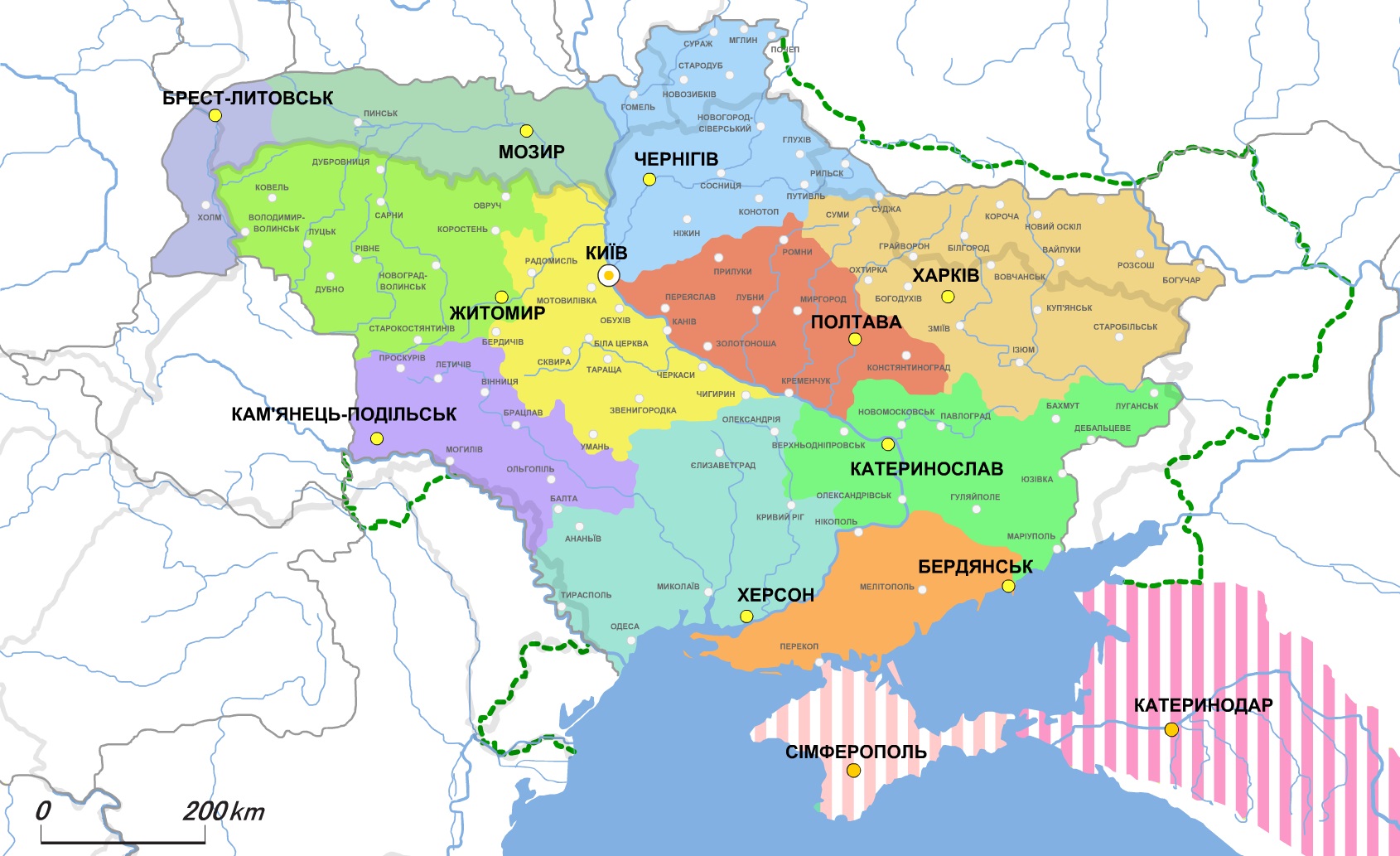
Above: Map (found online, source unknown) showing the territorial divisions of the Ukrainian State. The striped areas of Crimea and adjacent Russia were states in their own right which sought alliance and/or federation with Ukraine late in 1918 for mutual defense against the Bolsheviks. The orange area above Crimea is the old imperial Taurida Governate (Taurien to the Germans) which was occupied by 212.ID.
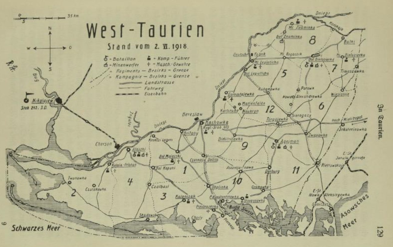
Above: Map from the regimental history of IR 415 showing their district of occupation as of 2nd June 1918, including division into company sub-districts as well as locations of regimental and battalion staffs and of the regiment's organic support weapons (machine-guns and light Minenwerfers). Note the lack of railway lines within the district, necessitating reliance on the Dniepr and the road network (such as it was) for internal transport.
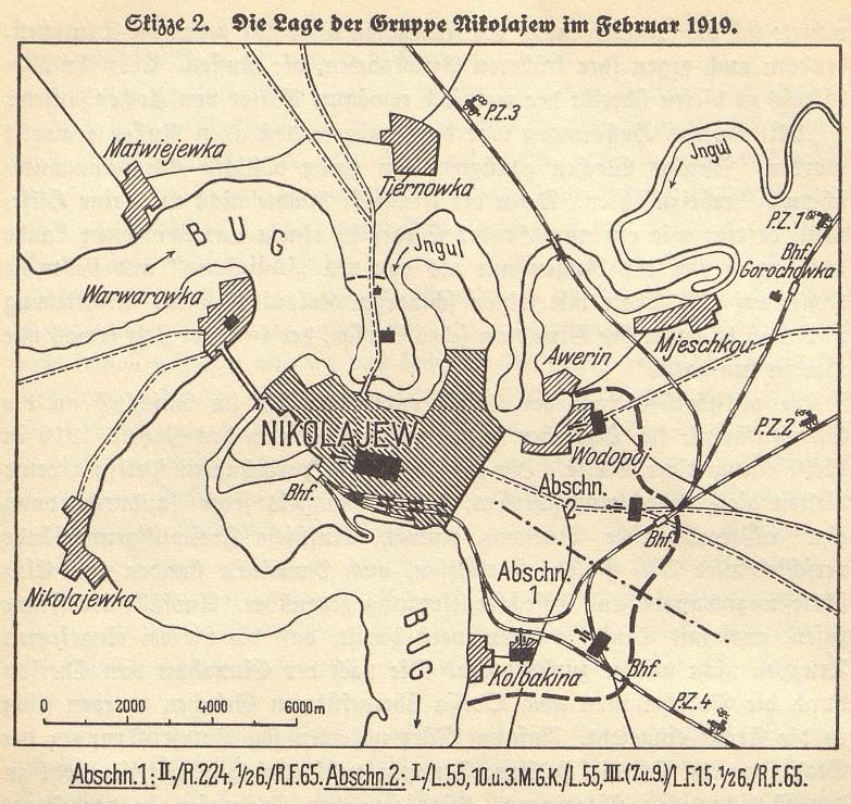
Above: Map from Die Rückführung des Ostheeres showing Nikolajew / Mykolaiv and its defensive perimeter as of February 1919. Note especially the locations of the railway lines and their allocation to the German garrison's four improvised armoured trains (Panzerzug I-IV)