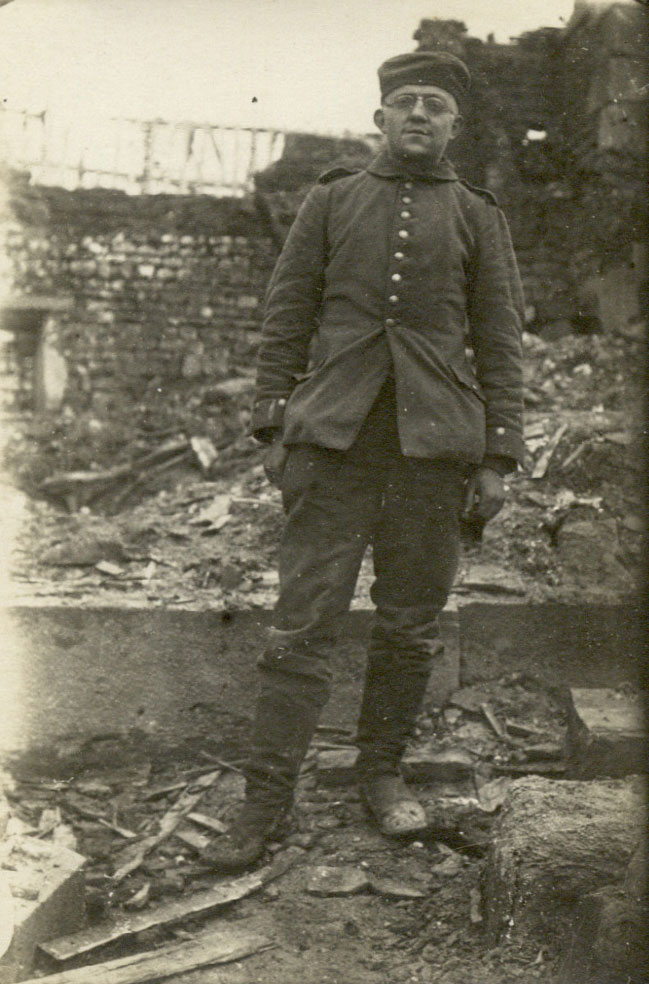
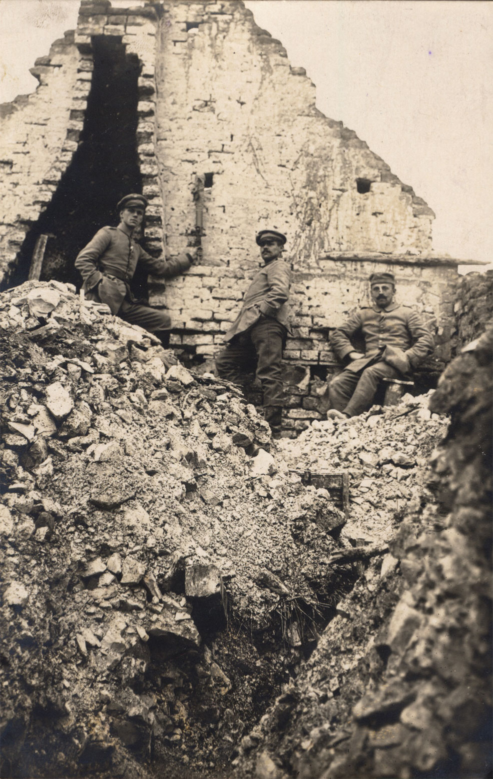
Above: Arno in La-Ville-aux-Bois around May 1915; the reverse reads "taken in La-Ville-aux-Bois according to letter of 3rd June 1915". Most regrettably, no wartime letters from Arno (and only two cards with significant text on the back) are known to have survived. Note how tight and ill-fitting his Waffenrock appears- mainly because both of his front skirt pockets (and his right trouser pocket) are full.
This also reveals how high-waisted these uniform jackets were, putting the belt equipment at a convenient height while making the wearer look taller! Despite my best efforts I have not yet been able to identify the exact location depicted here. Any suggestions would be most welcome.
FAR 48 would remain on the Aisne for almost two years before being transported to the southern part of the Somme battlefield, where elements of the corps had been fighting the French since July 1916. Regrettably, none of Arno's surviving photos from the Western Front are dated later than this period on the Aisne, and all but two are believed to be from the first half of 1915. While working on this series, I have become increasingly conscious of how much of Arno's story is missing. My belief is that his letters to his future wife, his Militärpass and Soldbuch and his medals were with other valuables stolen from my great-grandmother's flat after her death. What happened to the rest of his photos (for which space visibly exists in the relevant album) is a complete mystery. However we do know from his post-war CV that he remained with FAR 48 until demobilisation and was never so much as wounded (at least, not seriously enough to merit a mention in the published Verlustlisten). My research in the regimental personnel files in the Saxon Archives in Dresden has found brief mentions of him by name as late as Christmas 1916, always as a Gefreiter and (when identified by sub-unit) a member of the 3. Batterie.
Among Arno's surviving photos, the largest identifiable group was taken in a single fortified village on the divisional front. La Ville-aux-Bois-lès-Pontavert (literally 'the town in the Pontavert woods') lies a couple of miles north of the Aisne, slightly to the west of the main Laon-Reims road. As the name suggests, it was and is surrounded on three sides by woodland - most notably the Bois des Buttes to the south-west, which conceals a low rise with several peaks. Though seemingly slightly larger today than in 1914, the population in recent years has only been around 100-150.
Following the Battle of the Marne in September 1914 and the subsequent German withdrawal, this quiet spot became a focal point of a French attempt to push into a gap in the German defensive front. The Saxon XII. Armeekorps was among the forces deployed to counter this move, and on 15th September Schützen-(Füsilier-)Regiment "Prinz Georg" (Königlich Sächsisches) Nr.108 (henceforth SR 108) launched its first attack on La Ville-aux-Bois, supported by IR 178 and IR 182. The village was finally secured two days later, and repeated attempts were then made to take the Bois des Buttes before the battle subsided into routine trench warfare. The higher ground in the wood, jokingly referred to by the Saxons as the Berg von La-Ville-aux-Bois (La-Ville-aux-Bois Mountain) or Viller Berg would remain a constant bugbear for the village garrison until its capture by SR 108 and GR 101 on 10th March 1916 in a diversionary operation for Verdun. Until the end of March 1915 the village was held alternately by elements of SR 108 and IR 182 (together forming 46. Infanterie-Brigade within 23. Infanterie-Division). At that point the division was reduced from four to three infantry regiments with the departure of IR 182, and its front redivided into three regimental sectors which would remain largely consistent for the rest of their time on the Aisne. Thus 'La Ville' became the established home of the Schützen-Regiment. Although the French had the advantage in observation from the Viller Berg and their front line lay dangerously close at the edge of the woods (so that trench mortar bombardments and aggressive forward patrolling were regular features of life in this sector), the village would be regarded with some fondness in later years when SR 108 was serving on much more dangerous fronts.
So - you may well ask, what was my great-grandfather doing in 'La Ville'? As we have seen, his battery was deployed near the Juvincourt-Corbeny road, in direct support of SR 108. The forward observation officers of FAR 48 would certainly have had good reason to visit the village, as would the runners and telephonists who supported them. However the answer almost certainly lies in the photo of Arno with the crew of a Belgian 5.7cm Maxim Nordenfelt fortress gun- two of those men, including the gun commander, reappear in his photos from La-Ville-aux-Bois. The Belgian fortress guns were supplied to the division at the end of March 1915 as a close-defence weapon for the infantry lines, intended to counter French use of similar small-calibre 'trench artillery'. We know from photographic evidence that one of these 5.7cm pieces belonging to FAR 12 was emplaced in the trenches of GR 101 at Le Cholera, and also that a 5.3cm Krupp-Gruson Fahrpanzer (essentially a small armoured turret on wheels) with a Prussian Fussartillerie crew was employed in La-Ville-aux-Bois itself. As for FAR 48, Jürgen has pointed out the following passage in their published history (p.79), referring to the changes brought on by the ongoing reduction of batteries from six to four guns apiece:
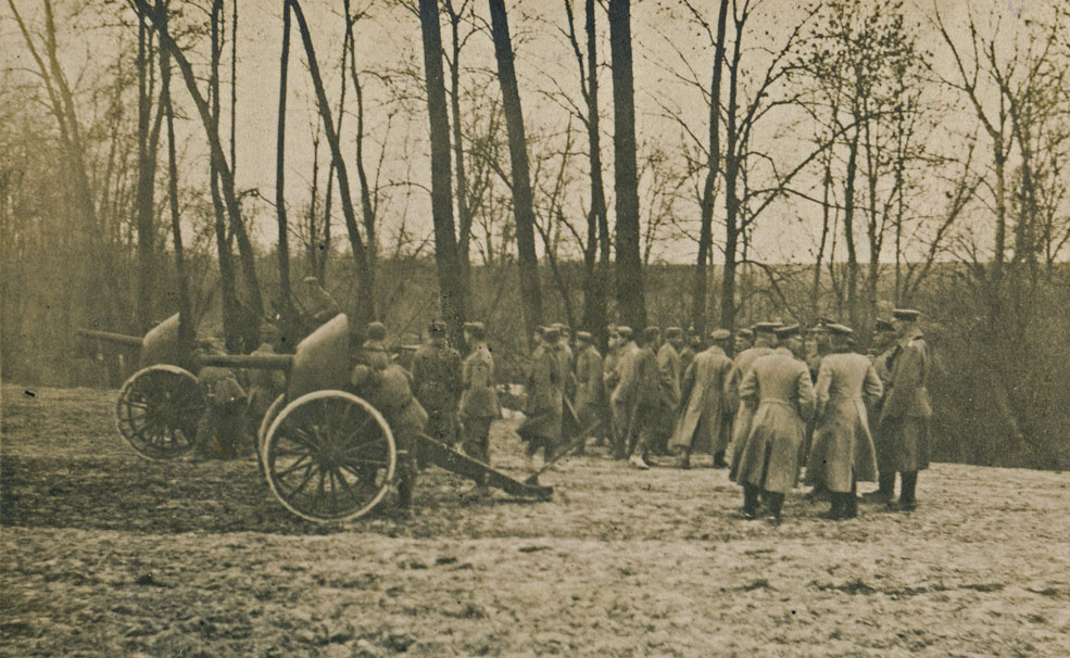
Above: testing of 5.7cm Nordenfelt guns, apparently by artillerymen of XII. Armeekorps early in 1915. The text on the reverse does not identify the writer's unit, but notes his location and date as Amifontaine (4km north of Juvincourt), May 1915.
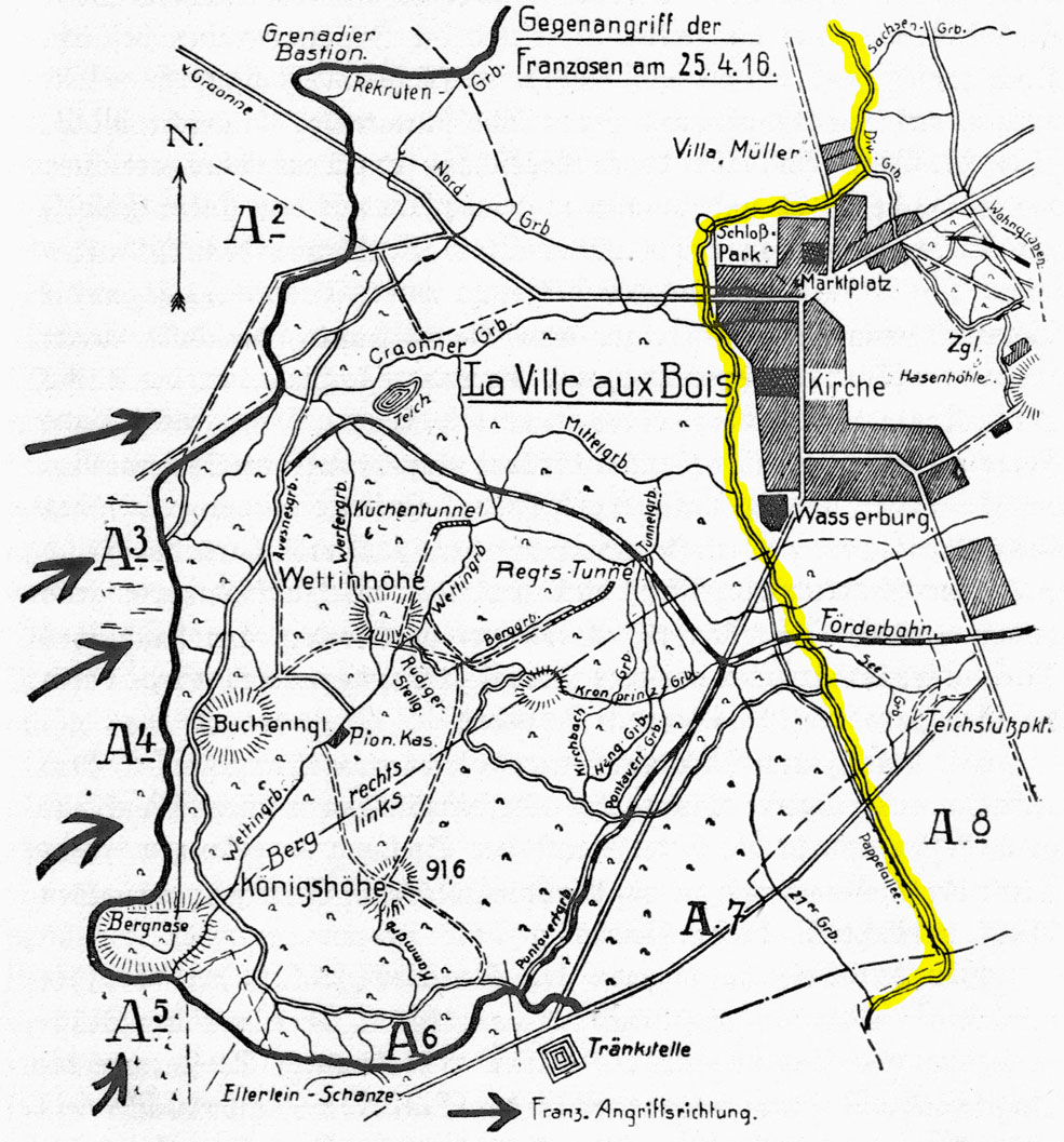
Above: the published history of Schützen-Regiment 108 includes numerous maps, but no entirely satisfactory one of the La-Ville-aux-Bois sector as it was in 1915. The most detailed view of the various features of the village is offered by this map of the French counterattack of 24th April 1916, following the storming of the Viller Berg by SR 108 and GR 101 on 10th March 1916. I have highlighted the Saxon front line of 1915 in YELLOW. The broken line across the end of the Pappelallee marks the boundary with GR 101 on the left.
So far as I can tell the right-hand boundary of the SR 108 sector (and of the divisional sector as a whole) was slightly beyond the top of this map, at Le Poteau on the Laon-Reims road. Beyond that point lay Prussian LIR 13 of 25. Landwehr-Brigade, attached to XII. Armeekorps since October 1914. Trenches ran around the western perimeter of the village, with heavily sandbagged ruins and the fortified walls of the Schlosspark and churchyard behind them as a further line of defence. The Schloss and Wasserburg formed the primary strongpoints of this position.
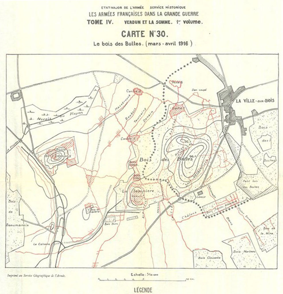
Above: French map of their positions in the Bois des Buttes prior to the attack of 10th March 1916. Note how close their front line was to the Saxon perimeter at the western edge of the village.
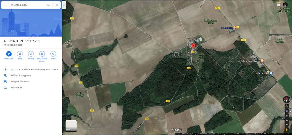
Above: Google Earth satellite image of La-Ville-aux-Bois as it appears today. While the village was completely levelled by the end of 1915 and now lacks any recognisable buildings, the street layout is essentially the same and the new church seems to have been built in the footprint of the original one. Numerous structures built by the Saxons in 1916 (and used in 1917-18 by other German units, the French and even- briefly- the British) still exist in the Bois des Buttes, including tunnels and concrete bunkers.
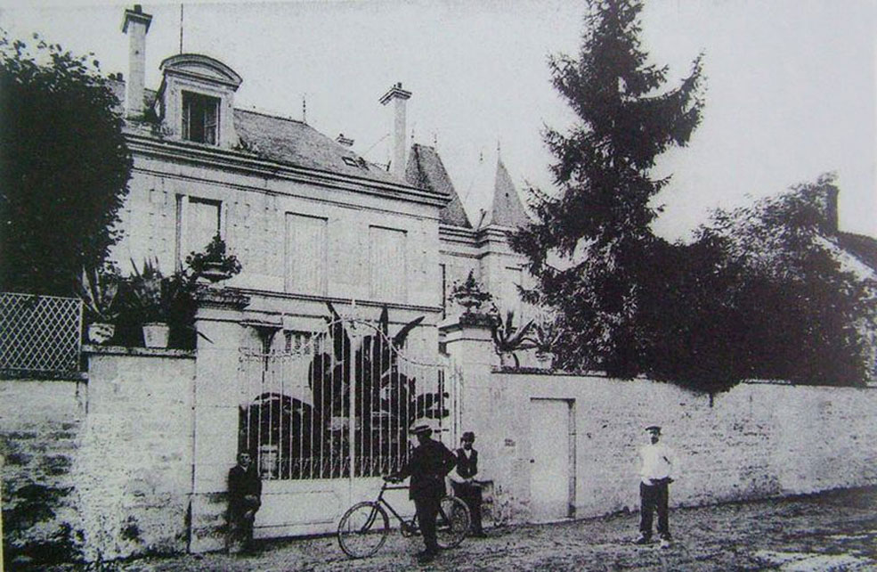
Above: French pre-war postcard of the chateau of La-Ville-aux-Bois seen from the eastern side. Another French postcard (not reproduced here) claiming to depict the chateau of La-Ville-aux-Bois but actually depicting an entirely different building, identifies the owner as 'le comte de Sache' or possibly 'de Sachs'. The latter would ironically suggest descent from one of the numerous illegitimate offspring of Friedrich August I, Elector of Saxony and King of Poland! Whether this individual was actually the owner of the chateau of La-Ville-aux-Bois is currently unknown to me.
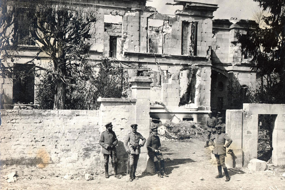
Above: photo from the album of Hans Berthelen (SR 108), showing the ruins of the chateau (Schloss) seen from the eastern side around February 1915. The numerous bullet holes bear witness to the fierce house-to-house fighting for the village. The regimental history of SR 108 notes that during the first assault on 15th September 1914 the chateau was a focus of the French defence, and only cleared after a 'bloody struggle'.
Similarly at the end of July 1915 it would be selected by the Saxons for fortification as a Stützpunkt (strongpoint), together with the Wasserburg at the other end of the village. On closer examination graffiti can be seen on the gateposts. Most notably, a hunting horn with '108' in the middle can be seen on the left gatepost between the officer with the walking stick and his seated colleague (a medical officer). Credit: Jürgen Schmieschek collection.
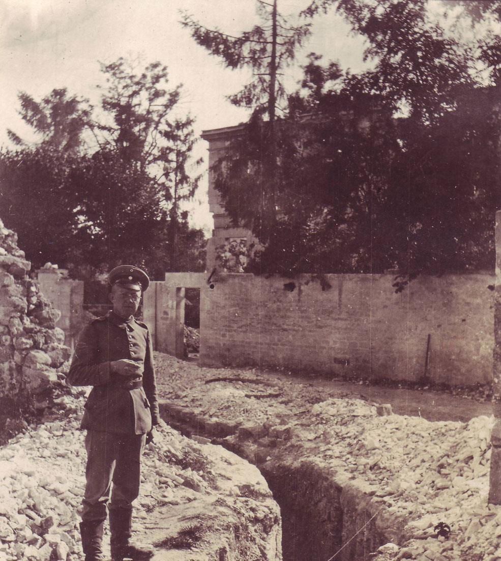
Above: undated photo of Arno in front of the eastern side of the chateau, revealing a communication trench now dug through the middle of the street. The left-hand gatepost has now collapsed and the trees are in bloom, helping to screen this area against observation from the Viller Berg.
This is the only known photo of Arno wearing a peaked Schirmmütze. Though any soldier could buy one, wear in the field was usually restricted by regulation to NCOs and officers. Since Arno was a Kriegsfreiwilliger-Gefreiter earmarked for potential promotion, this may have been an aspirational purchase. For all we know however, he may merely have borrowed it from his Unteroffizier for this picture!
Above: another photo from Berthelen's album, showing the rubble of the chateau around March 1916. It can be safely assumed that it was levelled when the village was subjected to intensive Trommelfeuer on 25th September 1915. Credit: Jürgen Schmieschek collection.
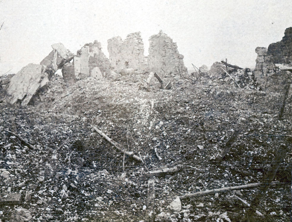
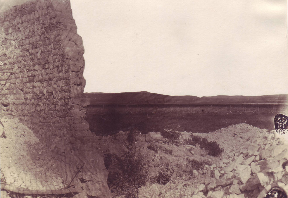
Above: another unidentified location in the village from among Arno's photos. The large stone blocks (and the large sculpted chunk in the right foreground) are suggestive of the chateau, but I have not been able to match this with any other pictures.
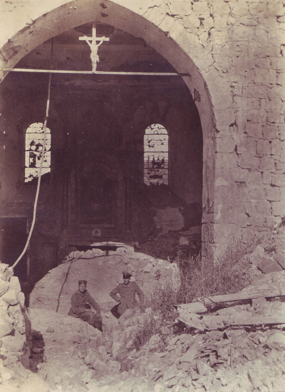
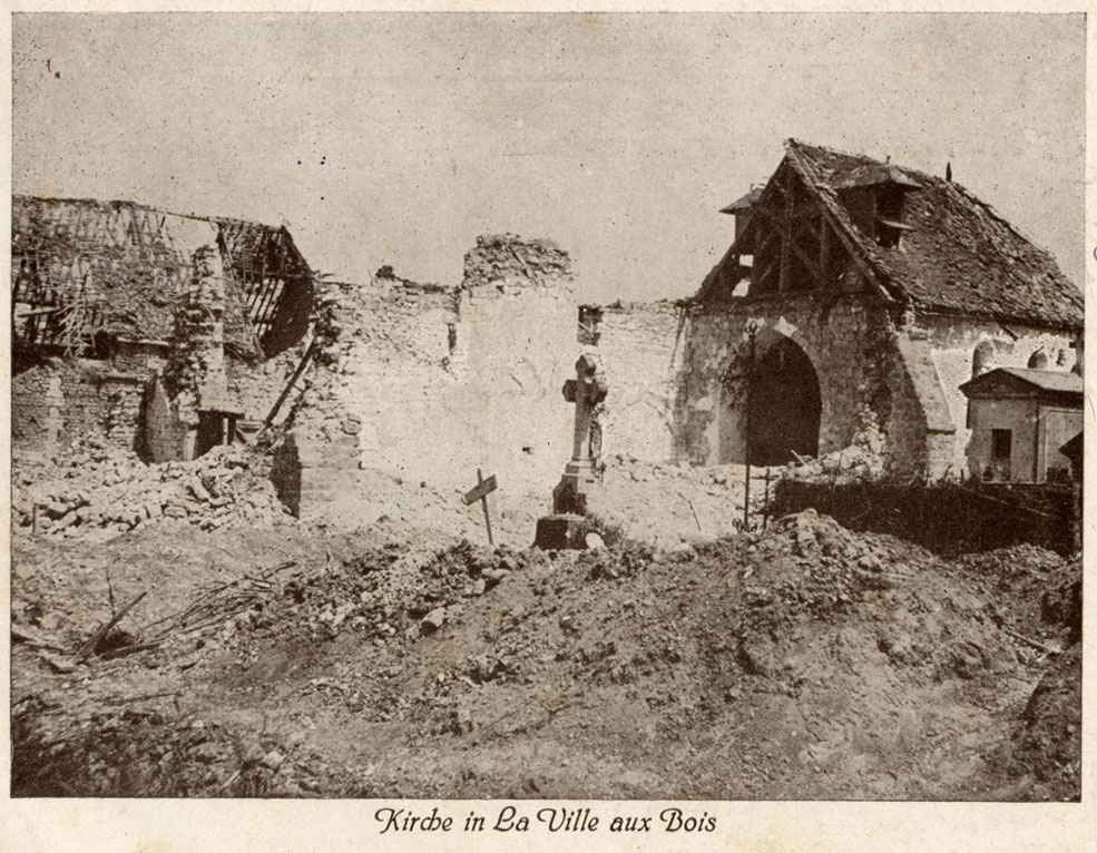
Above: Arno's undated photo of the village church, showing an Unteroffizier and Kanonier of his regiment in the ruined interior. Both men are recognisable from the picture of Arno with the Belgian 5.7cm gun. Perhaps Arno himself is the photographer?
Above: Hans Berthelen's photo of the village church seen from the cemetery wall (so with the photographer's back to the front-line trench system beyond) around February 1915. Due to their height and prominence, churches were both an obvious location for observation posts and a magnet for enemy artillery fire. Credit: Jürgen Schmieschek collection.
Above: commercial postcard of the church from 1915, revealing more of the devastated graveyard. This card was authorised for publication by the Saxon Interior Ministry, printed by C.C. Meinhold & sons of Dresden and sent through the Feldpost by a member of GR 101 in September 1915. Censorship of place names on commercial cards was only slowly and sporadically applied; on some in my collection, names have been half-heartedly scribbled over in pencil.
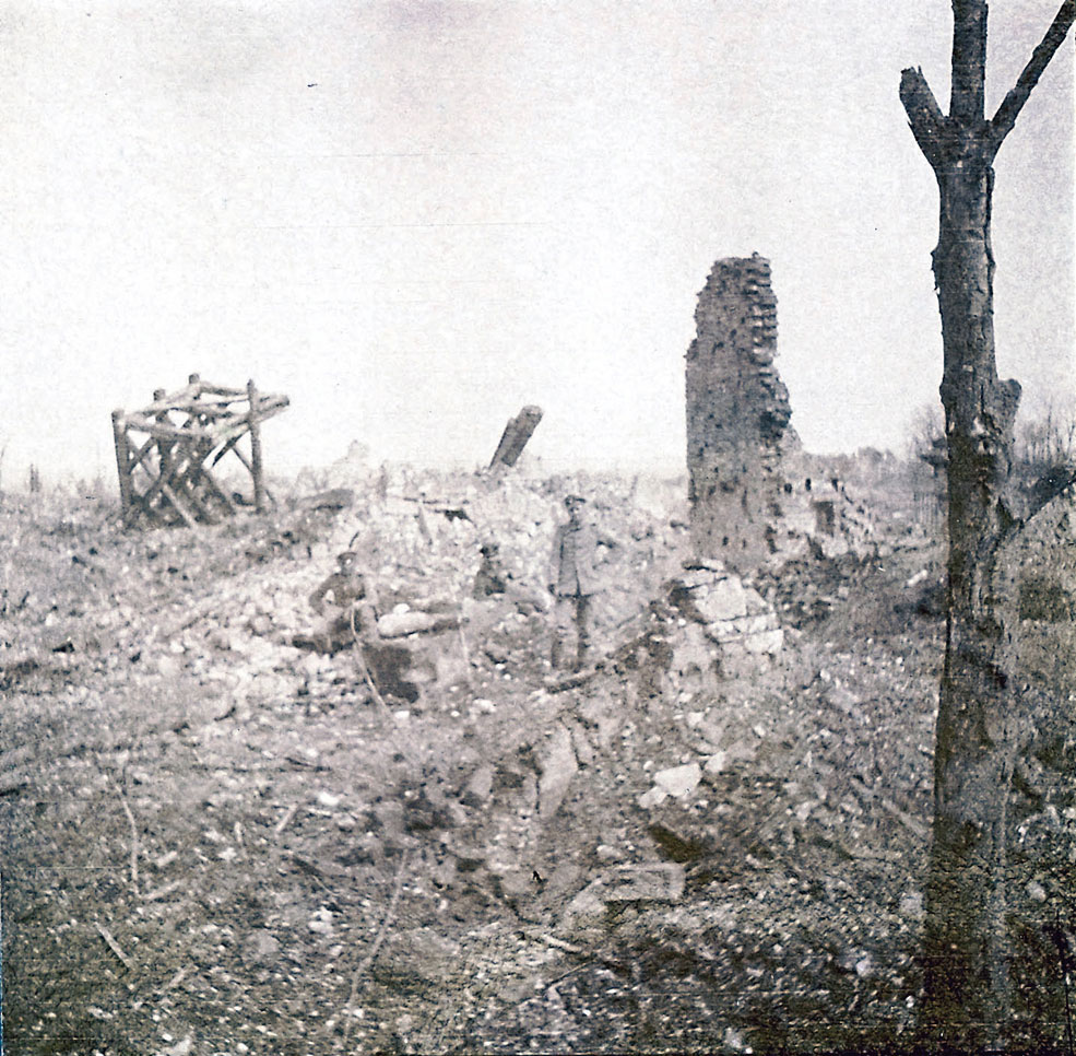
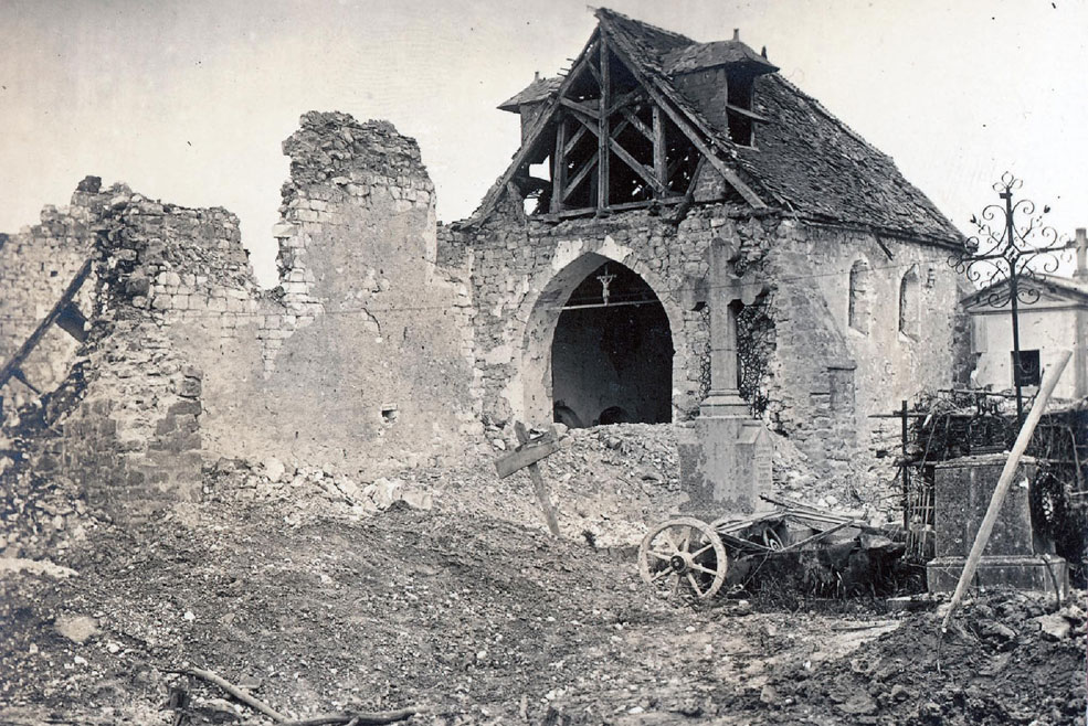
Above: the sad wreckage of the church around March 1916, as seen in Berthelen's album. The wooden framework of the roof is still recognisable on the left. Credit: Jürgen Schmieschek collection.
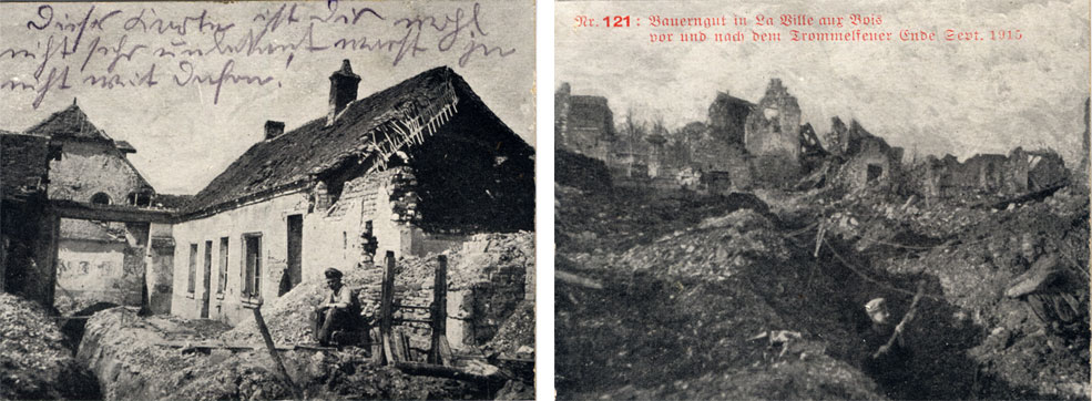
Above: paired images taken from a commercial postcard published by the prolific Blasewitz-based firm of Heinrich Knobloch, graphically depicting the state of the village both before and after the Trommelfeuer of 25th September 1915. Due to the opening of the Franco-British autumn offensive in Artois and Champagne, most of the Western Front saw a dramatic increase in hostilities and (in many cases) diversionary operations. While La-Ville-aux-Bois was hammered flat by heavy artillery, only a small number of the enemy were seen to leave their lines and no actual attack ensued.
Above: view of the village and the wooded Viller Berg beyond, seen from the Laon-Reims road (the present-day D1044). One French map from April 1917 shows a wire obstacle line covering the road on this side, as seen in this picture. The photo is part of a small group in my collection, all with the same handwriting and most printed with the name of a commercial photographer, Wilhelm Freudenberger of Niedersedlitz (near Dresden)- "currently in the field [with] 2./108".
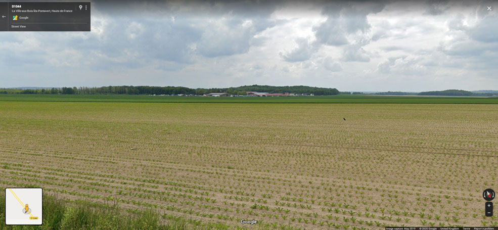
Above: present-day view of the village and the Bois des Buttes, seen from about the same location on the Laon-Reims road.
Above: another of Freudenberger's photos, showing an observation post on (presumably) the western edge of the village. At the periscope is Leutnant Ernst Clausen of 2. Komp. / SR 108. Ltn. Clausen would later be awarded the Ritterkreuz des Militär-St.-Heinrichs-Ordens for his leadership of the regiment's 3. MG-Kompagnie against the French offensive in the Champagne (near Moronvillers) in April 1917. Although wounded three times (the second and more severe being in the action for which he was decorated) he would survive the war.
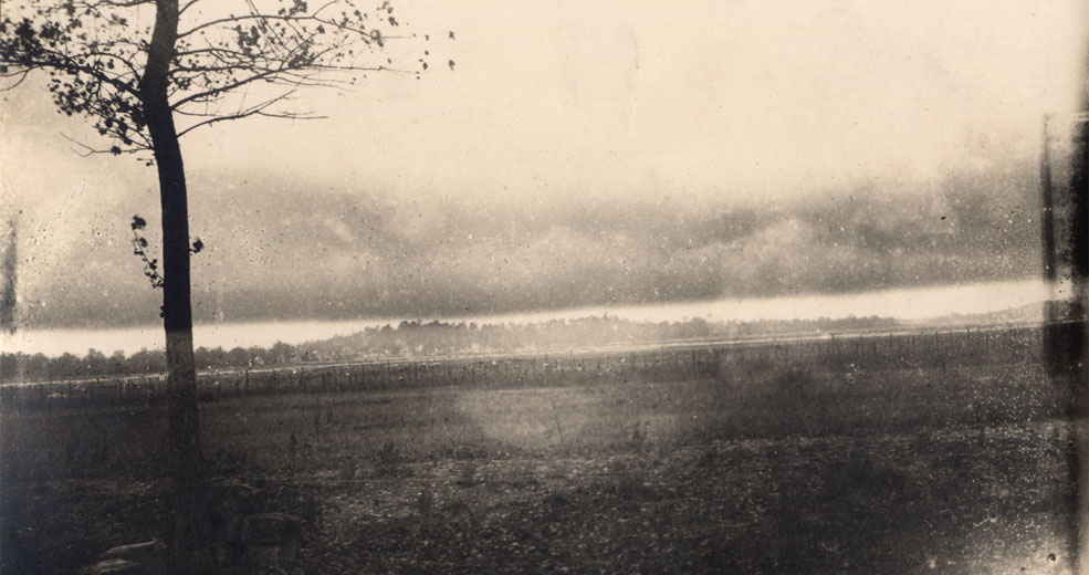
Above: another of Arno's photos from La-Ville-aux-Bois. My theory is that this is a view from the northern wall of the Schlosspark, looking northwestwards across the trenches on the division's right flank towards the heights of the Winterberg (Plateau de Californie) at Craonne.
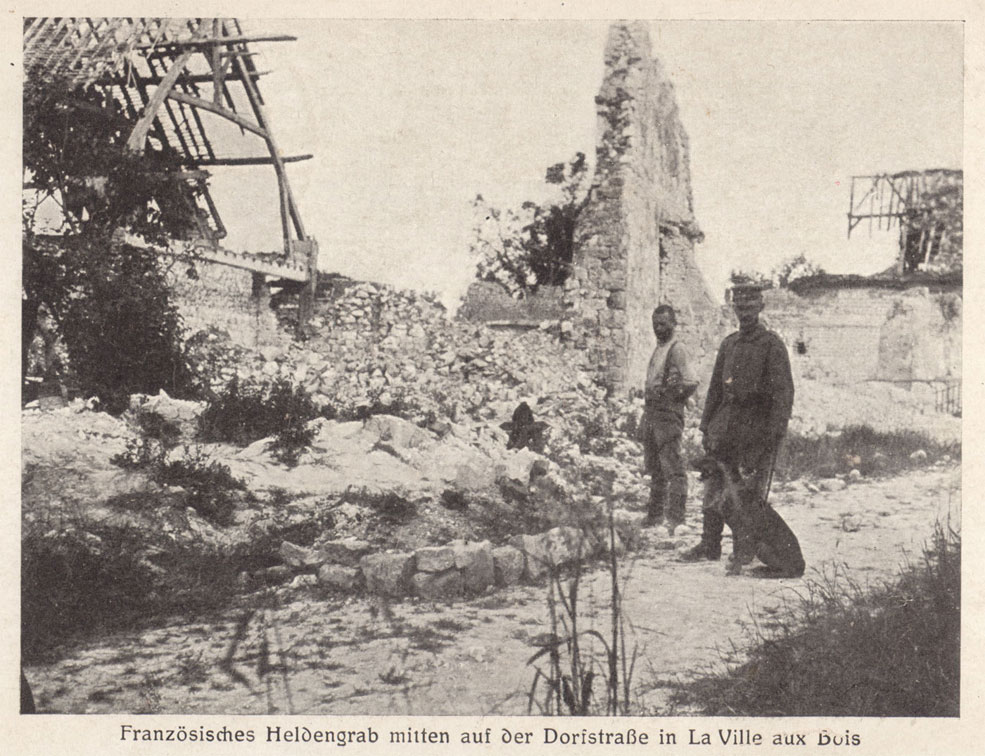
Above: commercial postcard from the firm of O. Peters (based in Jahnsdorf) depicting a French soldier's grave - no doubt from September 1914 - in the middle of the street. The frequently used term Heldengrab (hero's grave) was also respectfully applied to the enemy's dead. The German shepherd is probably a trained Sanitätshund (medical dog), as that breed of dog is known to have been used by 23. Infanterie-Division in this role as early as February 1915. Sanitätshunde were trained to assist the medical orderlies by locating the wounded on the battlefield.
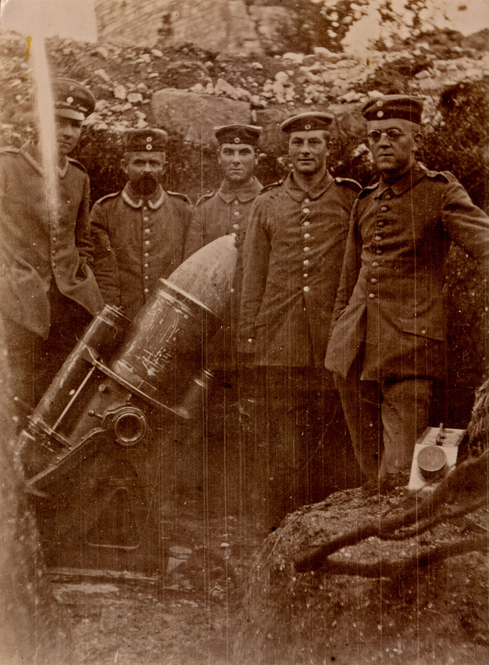
Above: I believe this photo is a souvenir of a visit by Arno and his Unteroffizier (the same one seen at the church and with the 5.7cm gun) to a 25cm schwere Minenwerfer firing pit near the western edge of the village. The three men with Prussian cockades are believed to be specialist Pioniere provided by AOK 7 (HQ, 7th Army), part of the actual crew of the weapon.
It is quite possible that the visit is a working one, as the artillery and Minenwerfer often needed to cooperate. Besides cooperating in combined bombardments, each could cover the deficiencies of the other - the Minenwerfer could destroy targets too close to the German trenches to be safely targeted by the artillery, while the artillery could engage targets beyond the effective range of the Minenwerfer (such as enemy artillery attempting to destroy it).
My theory is that this is the weapon mentioned on p.110-111 of the regimental history of SR 108 as being present in the village at the end of March 1915. This was used (quite successfully) to support a raid from the village against a suspected French mining gallery, falsely believed to run "from the north-east corner of 'La Viller Wald' [the adjacent wood] on the Craonne road toward La Ville about 40m opposite".
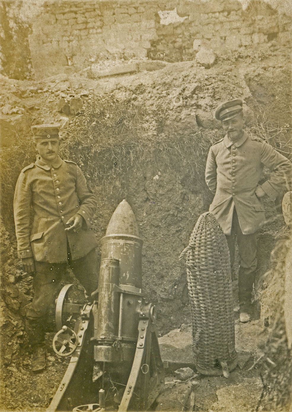
Above: another photo (dated 23rd August 1915 on the reverse) of the same mortar position, one of a group of pictures belonging to Max Wunsche of SR 108. This time the firing pit is seen from behind and above rather than from the right, revealing ruined walls both in front of and to the left. On the reverse Wunsche describes it as THE Minenwerfer in La Ville-aux-Bois, seemingly confirming that it was the only one there.
The basket on the left is for one of the weapon's monstrous 97kg shells (a comparatively modest 50kg version was also available); every single one of these would have to be carried forward by hand from the nearest field railway terminus. The Prussian crewman (left) can now be seen to have an oval badge on his left sleeve identifying his specific unit, a common practice in 1915 for Minenwerfer formations (which at the time would still have worn the same shoulderstraps as the Pionier-Bataillon or-Regiment from which their personnel were drawn). The man on the right is Max Wunsche's immediate superior, Unteroffizier Altenburg of SR 108.
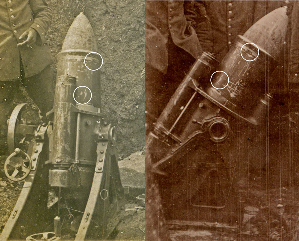
Above: close comparison of the paint scratches on the Minenwerfer in both photos reveals that it is exactly the same weapon!
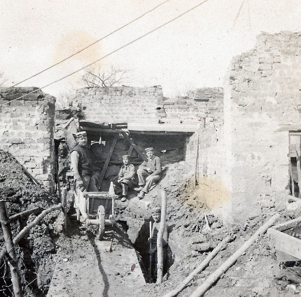
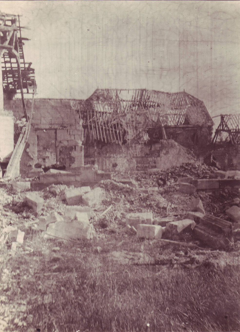
Above: a fascinating photo from Hans Berthelen's album, showing trench construction in progress in the village in 1915. The wall in the background appears to have been reinforced with sandbags, and what looks like a rudimentary rain shelter added.
The ruined village was freely exploited as a source of construction materials, which would otherwise need to have been carried forward by hand. Due to French observation from the Viller Berg, this could only be done by night and at considerable risk. However demolition of any building or wall which could conceivably interfere with the enemy's line of sight was strenuously avoided.
Initially the garrison of the village was accommodated partly in the cellars and partly in the houses themselves. After heavy shelling at the beginning of February 1915, it was recognised that even the cellars could not be relied upon to withstand prolonged bombardment. Fortunately the chalky ground was highly favourable for excavation, and deep shellproof dugouts were systematically constructed throughout the village over the subsequent months. Credit: Jürgen Schmieschek collection.